
Maps go blank
Map apps stream tiles from the internet. Without a connection you get a gray screen, and the same is true for the phone's navigation and search.
Offline maps · On-device AI · iOS & Android
GridDown puts offline maps with 4.4 million survival points of interest and an AI assistant trained on 40+ field guides on your phone. No signal, no cloud, no server that can go dark. Set it up once and you're ready.
Why you need it
The moment the power goes out for longer than a few hours, the tools you rely on quietly stop working. GridDown is built for exactly that moment, whether the cause is a storm, a grid failure, or something worse.
Map apps stream tiles from the internet. Without a connection you get a gray screen, and the same is true for the phone's navigation and search.
"How do I purify water?" is a question you Google. Every AI assistant on the market needs a server on the other end. When it's gone, so is the answer.
Cell towers switch to backup batteries once the grid fails. Most have hours of reserve, not days. After that, your phone is only as useful as what's already on it.
Lights, refrigeration, and internet at home are out. Cell service degrades as tower batteries drain.
Gas pumps, ATMs, and card readers are down. Water pressure drops in systems that depend on electric pumps.
Supply chains stall. Decisions about water, heat, sanitation, and whether to stay or go become daily and serious.
It has happened. After Hurricane Maria in 2017, parts of Puerto Rico waited close to a year for power to come back.
What's inside
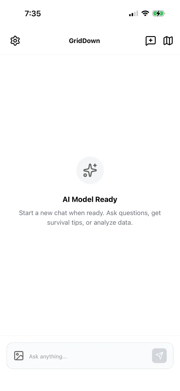
An AI assistant that runs on the phone's own processor, and a map that works the same whether you have five bars or none.
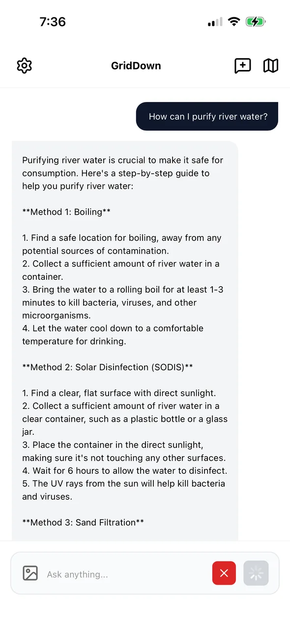
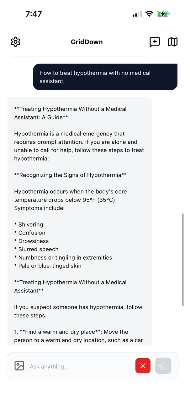
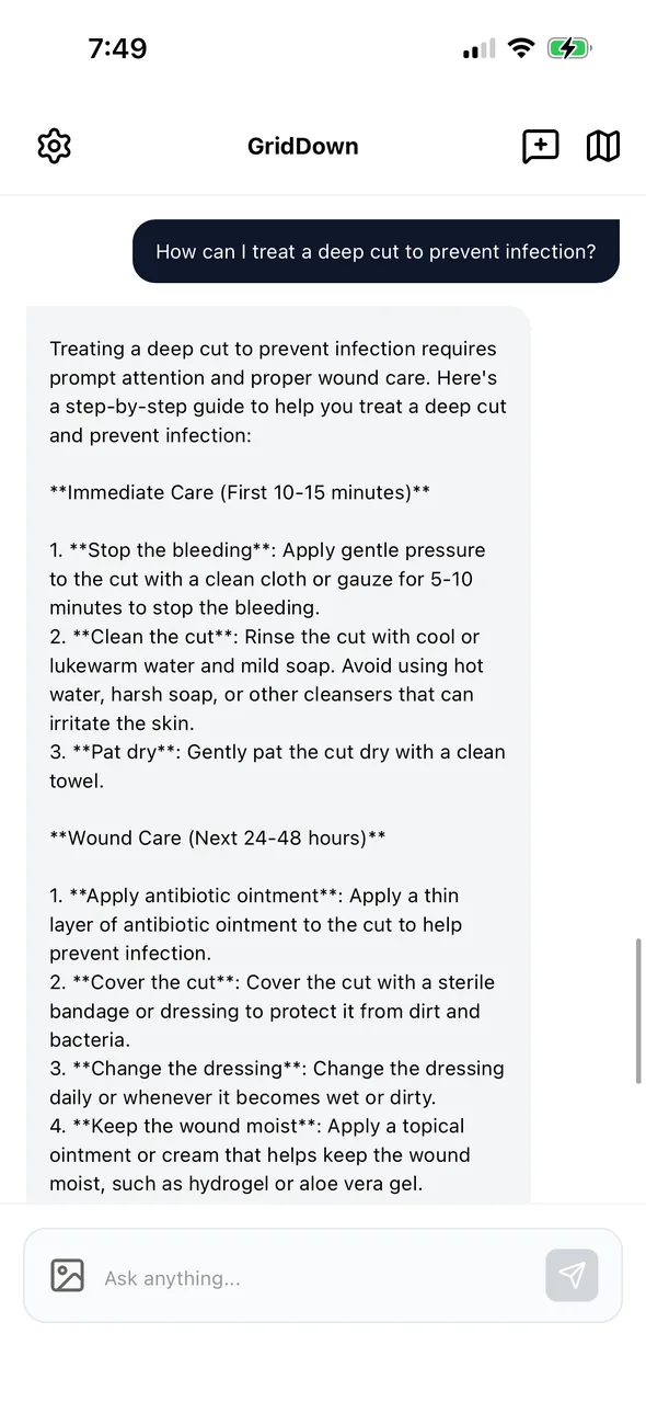
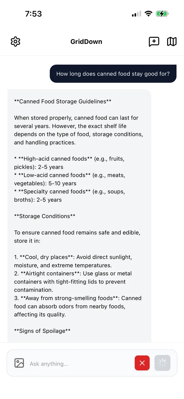
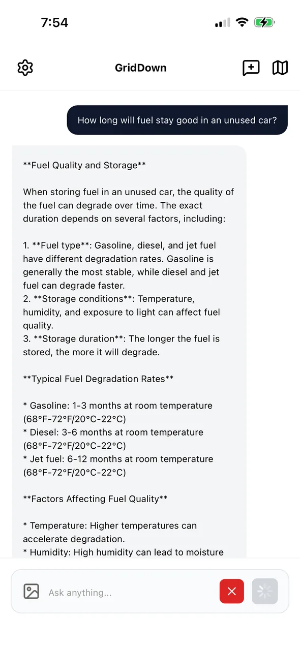
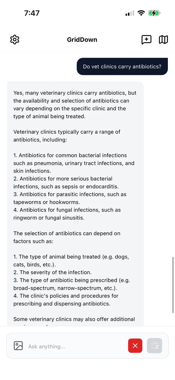
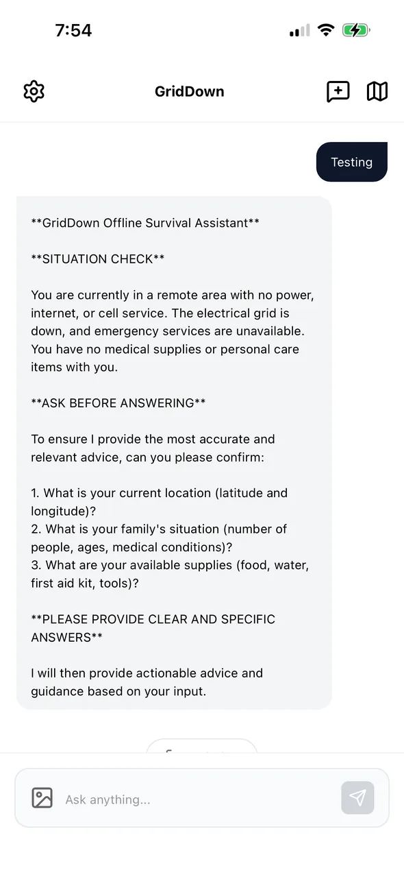
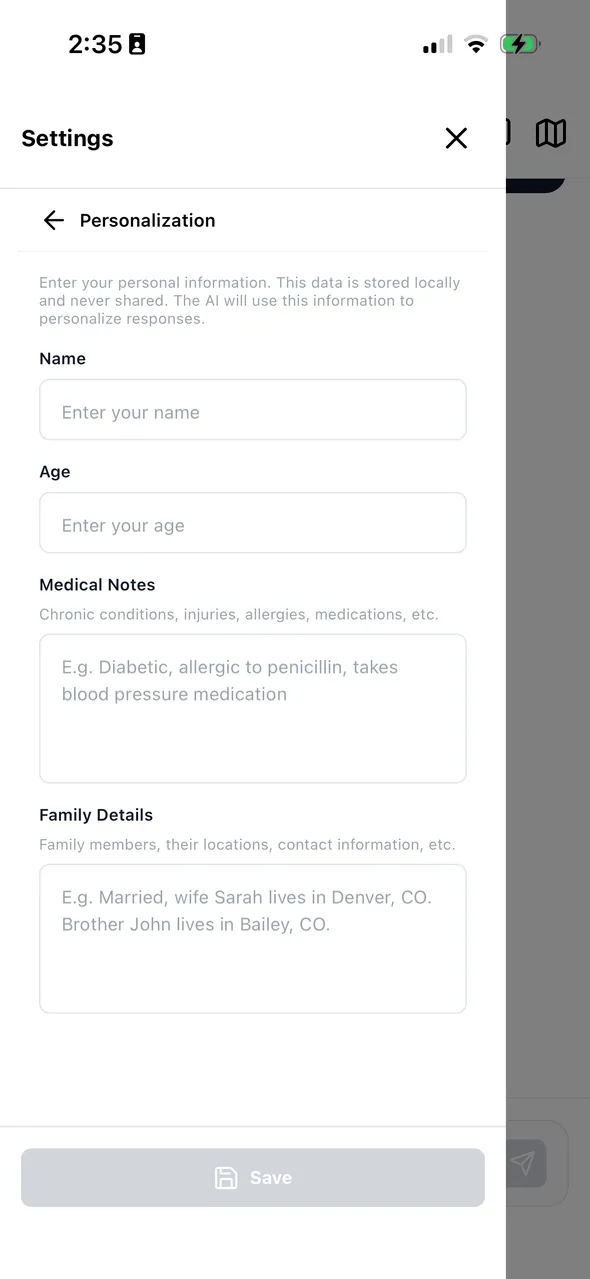
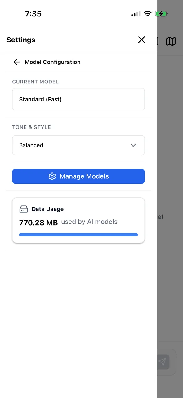
Works like the AI chat apps you already use, with saved chats, memory, personalization, and tone settings. Except it keeps working in airplane mode.
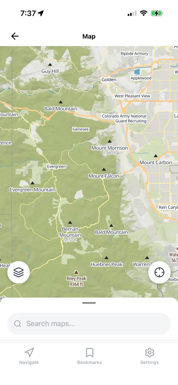
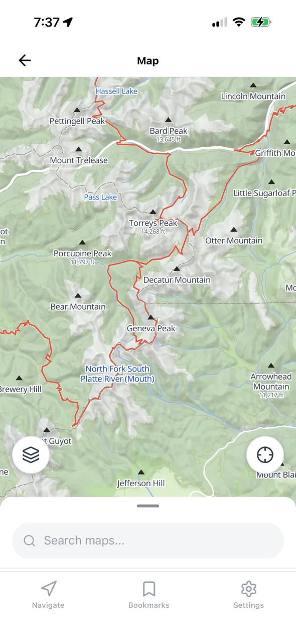
Offline mapsRoutes, bookmarks, search, and toggleable survival overlays over a map that's stored on the phone. Switches between online and offline on its own.
GridDown runs a language model directly on your phone. It's fine-tuned on survival and disaster-preparedness material and answers from a built-in knowledge base of 40+ field guides, with steps, warnings, and the source it pulled from.
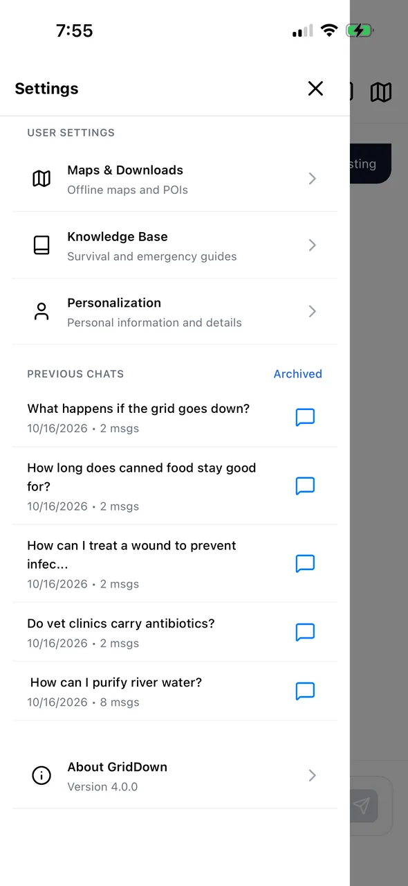
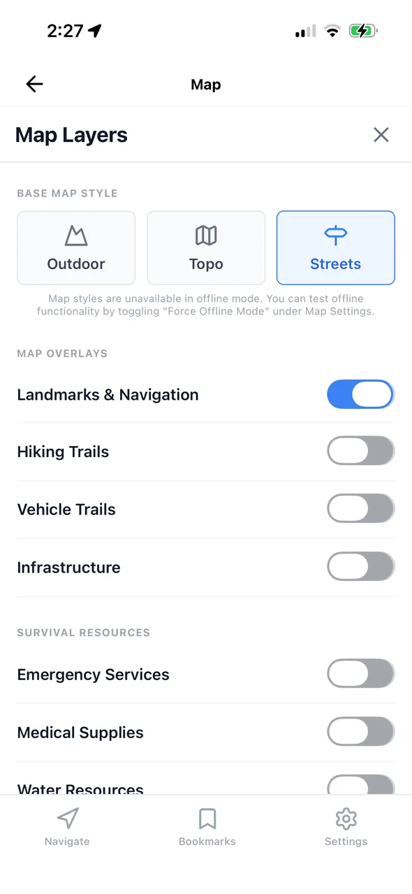
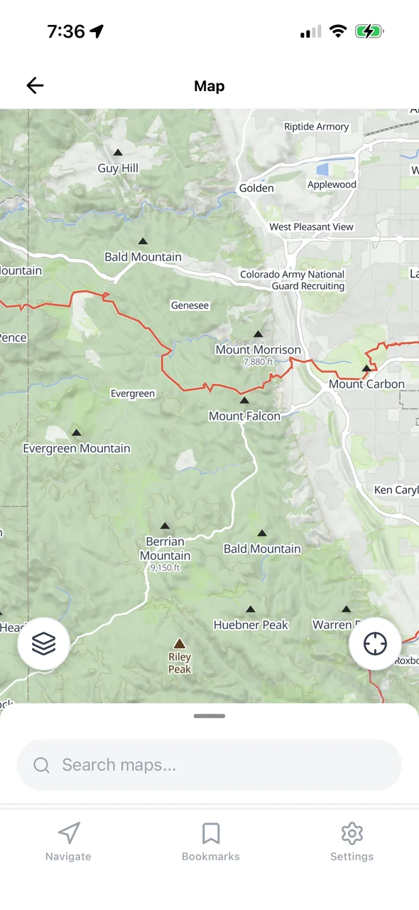
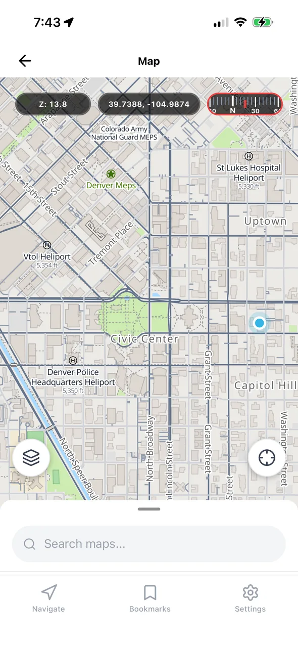
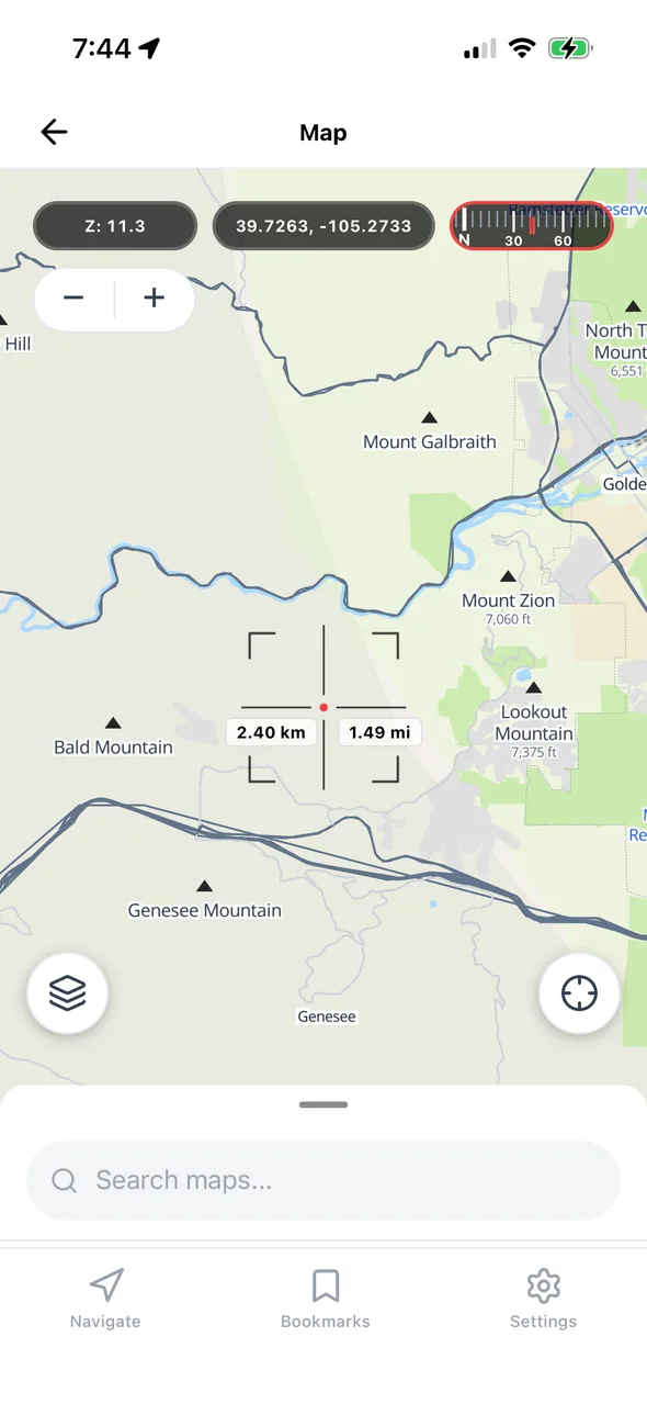
With a connection you get three live base maps: Outdoor, Topo, and Streets. Lose the connection and GridDown drops to the survival-optimized map stored on your phone without missing a beat. Every overlay, bookmark, and saved route works in both modes, even when coverage is spotty.
Map overlays
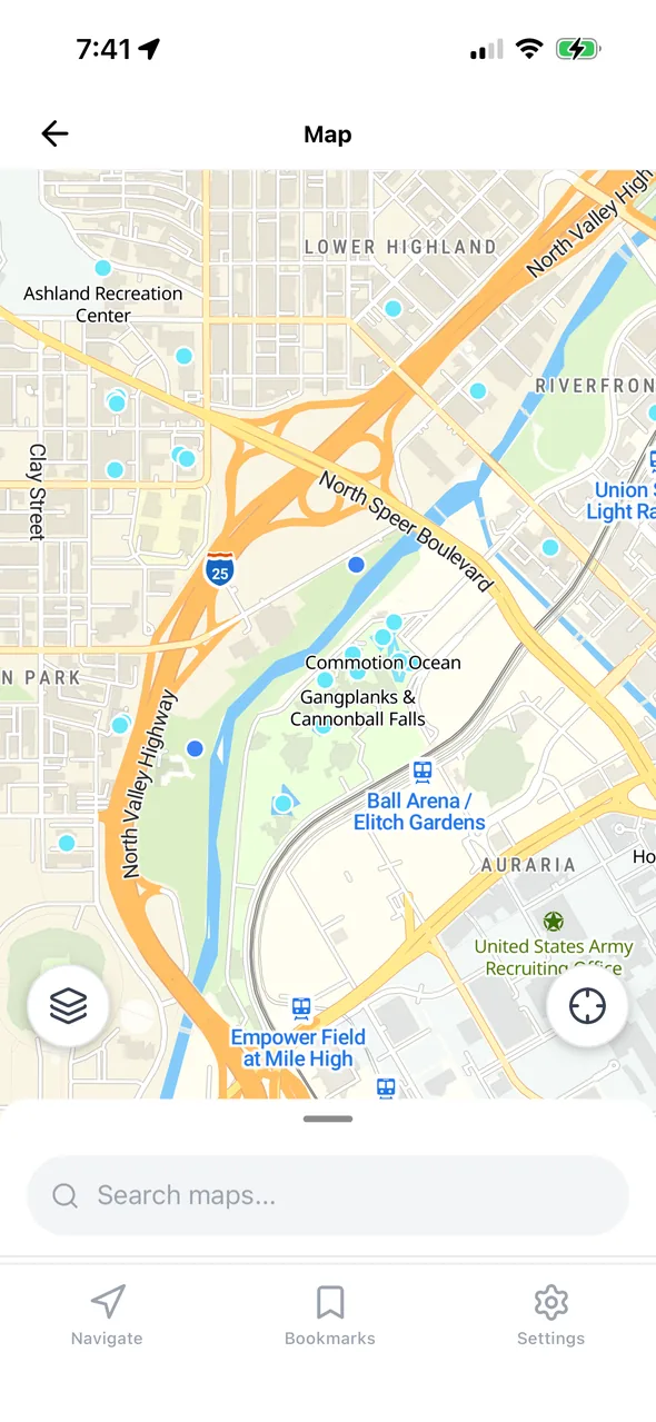
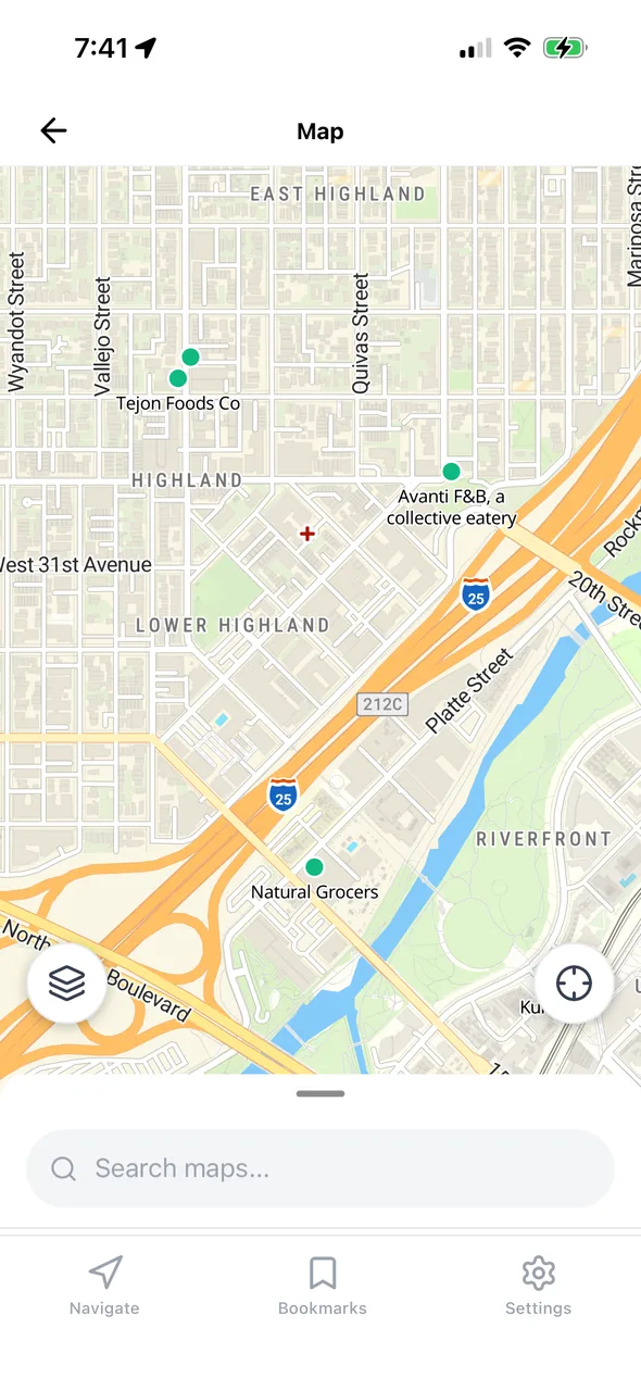
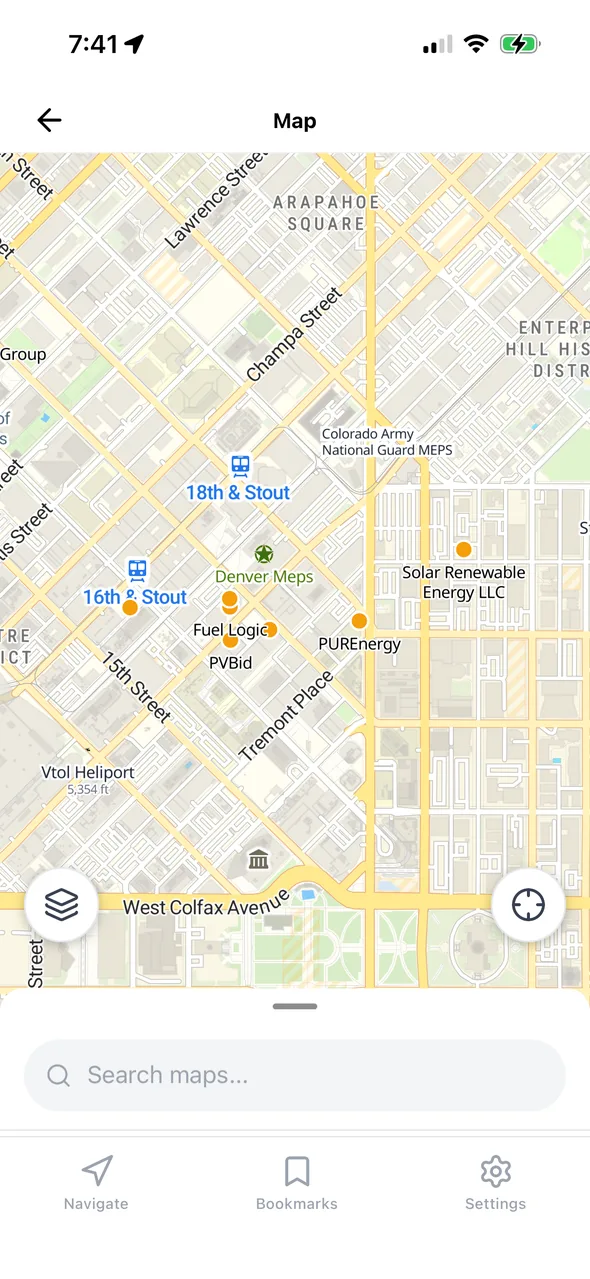
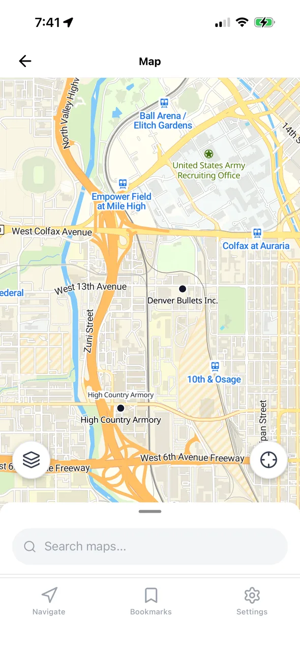
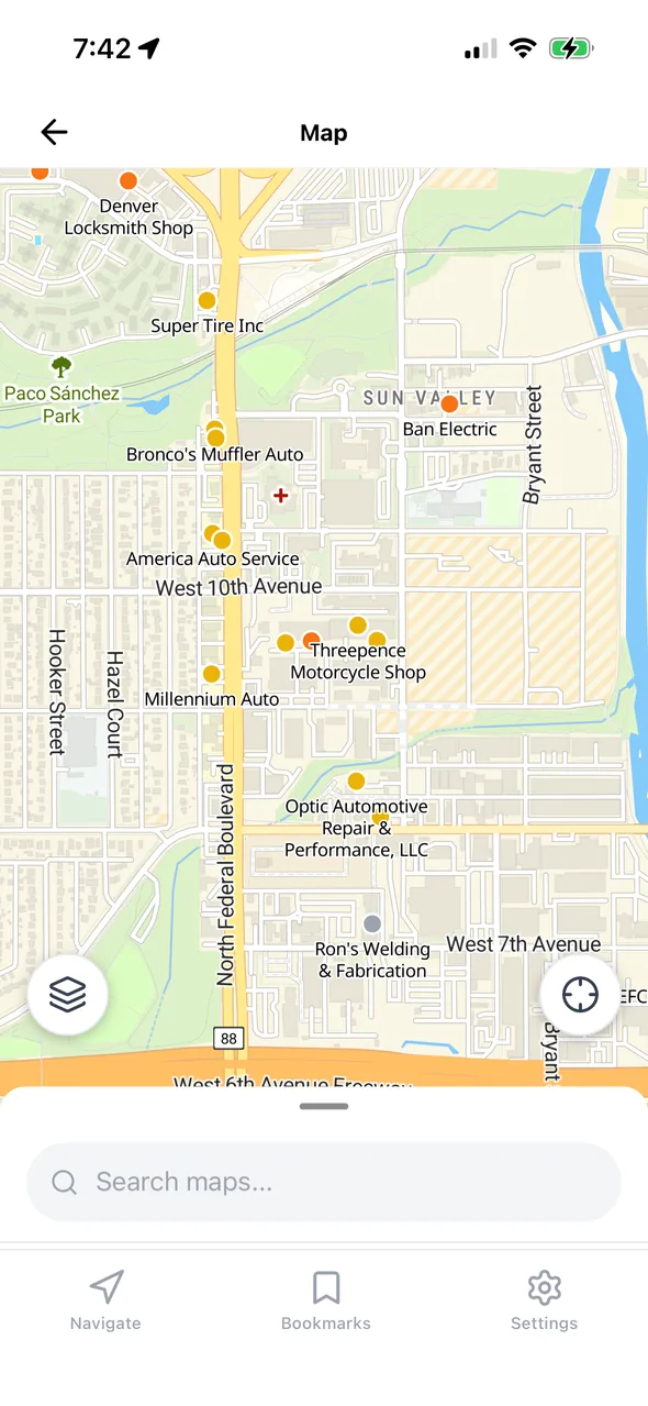
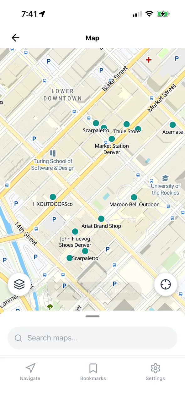
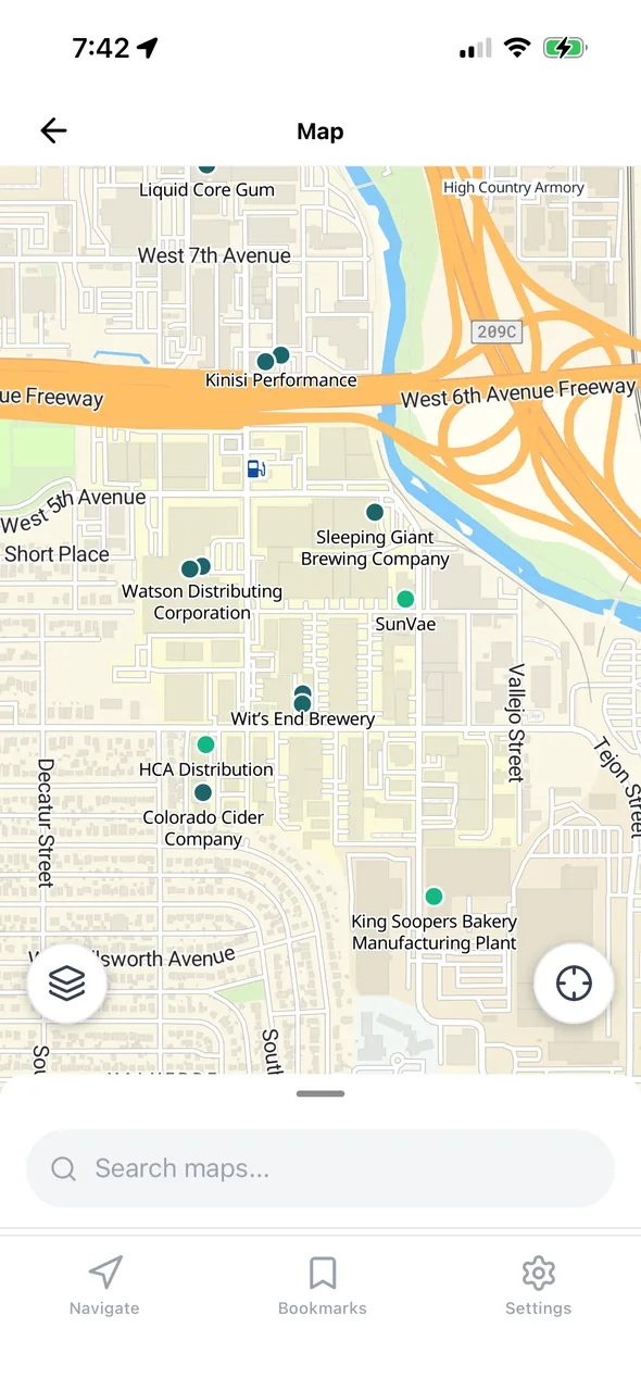
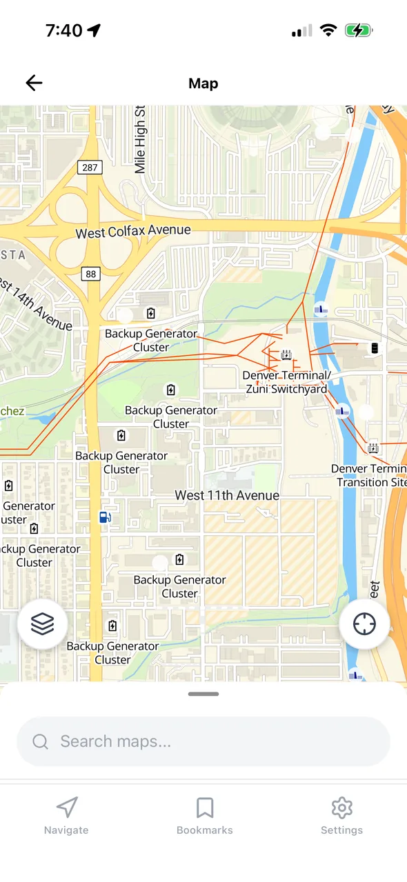
Standard maps show you coffee shops. GridDown's downloadable overlays show water, fuel, medical supplies, escape routes, and the infrastructure around you. Toggle each one on or off as you need it.
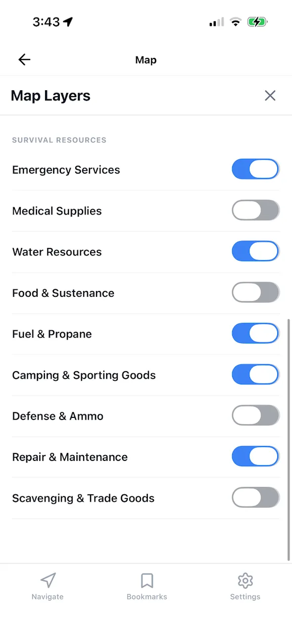
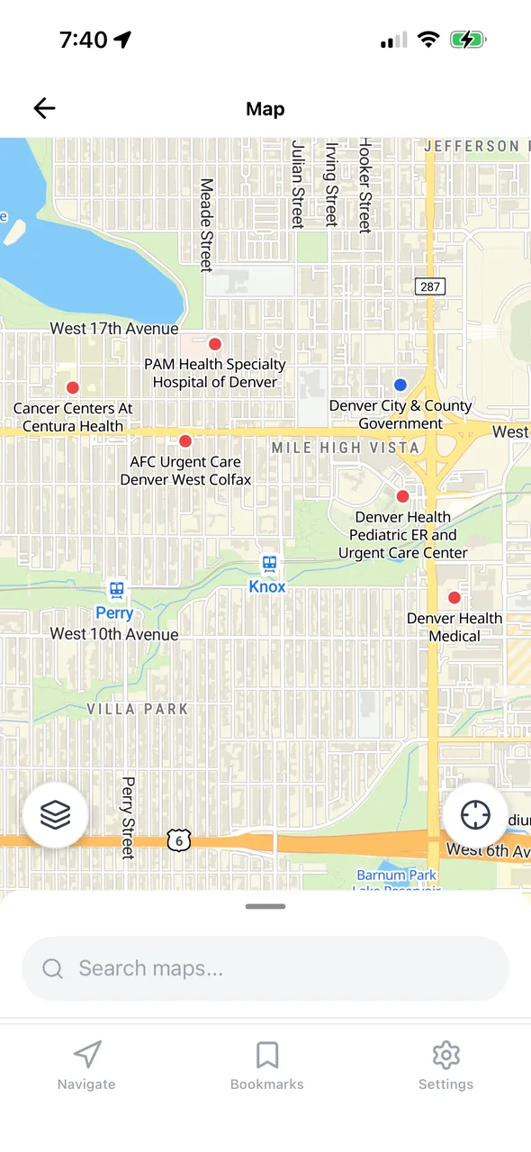
Nine categories of places you'd actually need, searchable offline and toggleable one at a time.
Built in, no download needed. Bridges, tunnels, dams, mountain passes, peaks, airfields, military sites, and more.
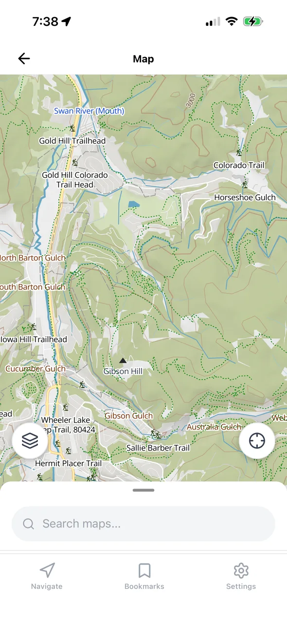
Off-road escape routes: hiking paths, bridleways, and foot tracks for moving through wilderness when roads are blocked.
4x4 tracks, fire roads, and drivable trails so you have options when highways are jammed or closed.
High-voltage lines, substations, backup generator clusters, railways, and pipelines. Available as a smaller power-grid-only download too.
Wetlands, quarries, landfills, and industrial zones, so you can route around hazards and read the terrain ahead.
Hillshading and elevation on the base map, so ridgelines, valleys, and drainages are obvious at a glance.
The database
The Survival POI database is built from Overture's open map data and filtered to 225 categories you'd need in a crisis, covering the entire United States. It lives on your phone and searches instantly with no connection.
Even before you download anything, GridDown includes a half-million-entry database of the places and terrain that define a region: the sites that will be defended, the fields where aircraft can land, the water you can walk to, and the passes you'd have to cross.
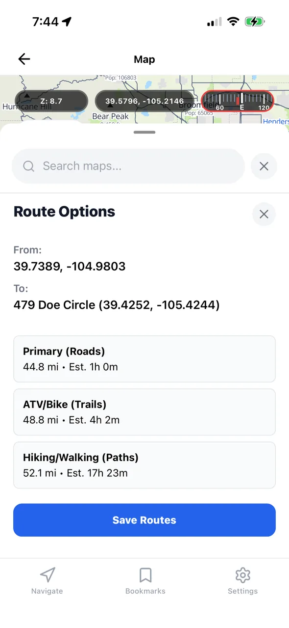
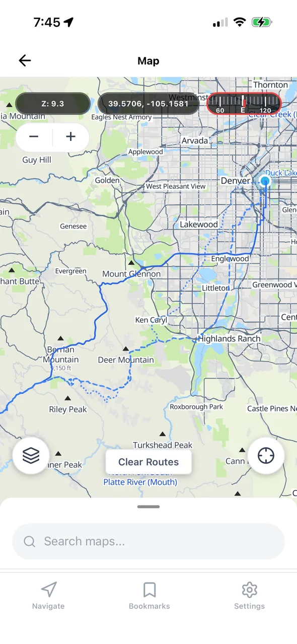
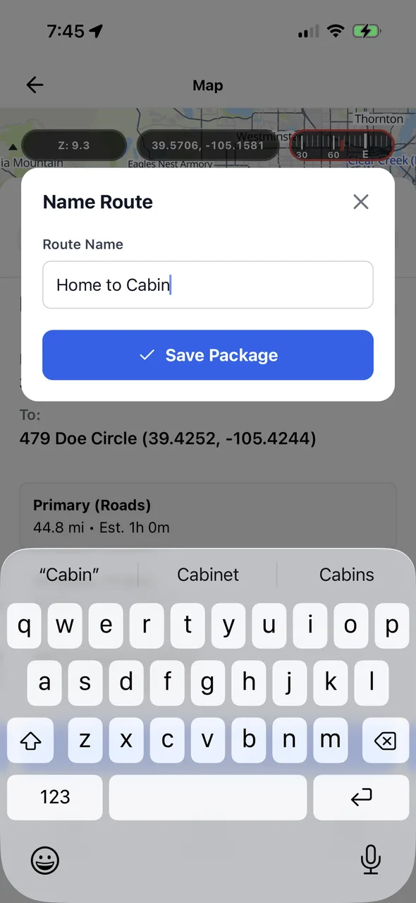
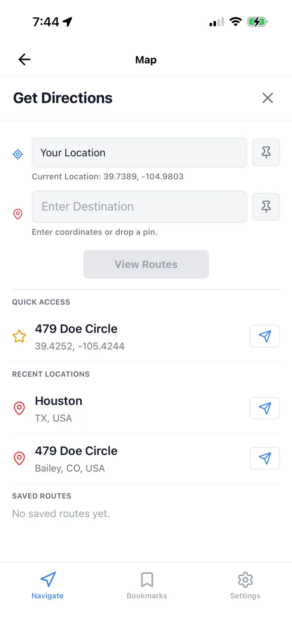
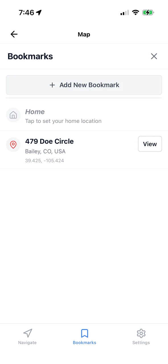
Pick two points and GridDown gives you three routes: by road, by ATV and bike trails, and on foot by hiking paths. Save the ones that matter and they stay on your phone, ready to open with no signal at all.
Example from the screenshots: one home-to-cabin trip, three ways to make it.
Downloads & storage
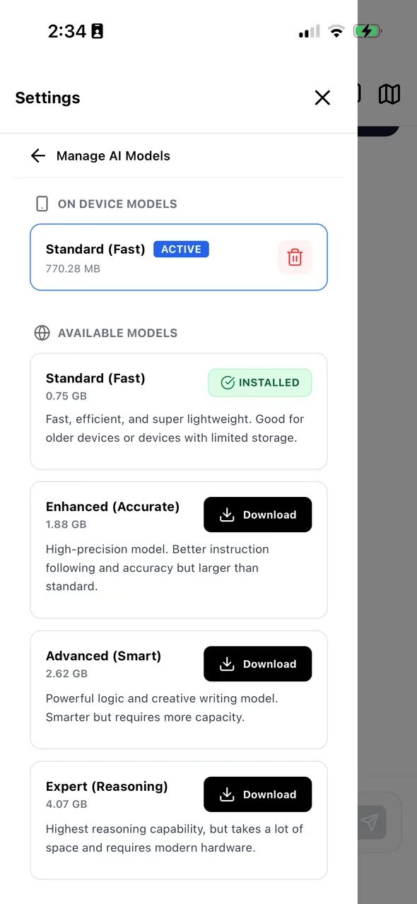
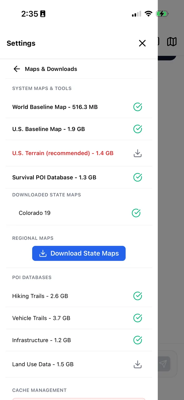
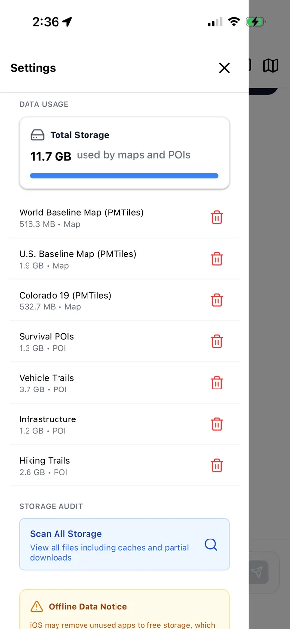
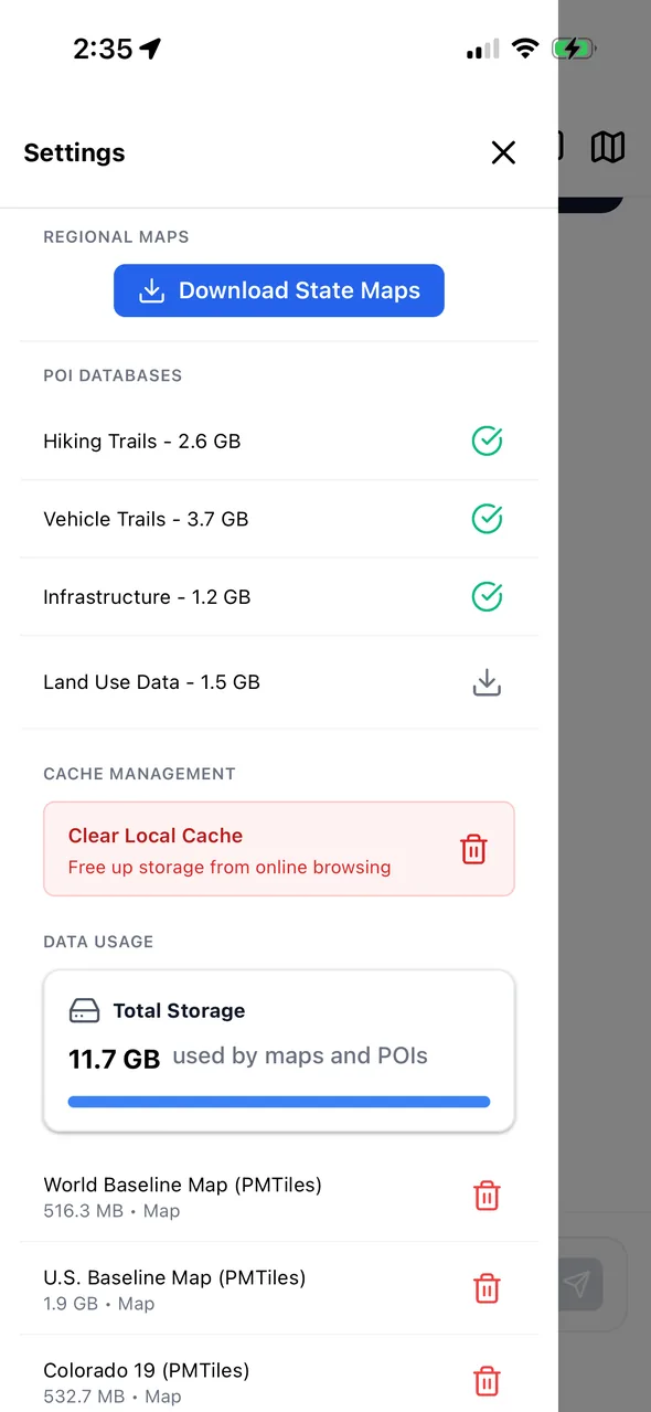
Every map, database, and AI model is a separate download with its size shown up front. Load a little or a lot, and audit what's on the phone any time.
| World baseline map | 516 MB |
| U.S. baseline map | 1.9 GB |
| U.S. 3D terrain | 1.4 GB |
| State map (e.g. Colorado) | 532 MB |
| Built-in landmarks & navigation | 768 MB, included |
| Survival POI database | 1.41 GB |
| Hiking trails | 2.77 GB |
| Vehicle trails | 3.93 GB |
| Infrastructure | 1.32 GB |
| Power grid only (stand-alone) | 395 MB |
| Land use | 1.65 GB |
| Standard (fast) | 0.75 GB |
| Enhanced (accurate) | 1.88 GB |
| Advanced (smart) | 2.62 GB |
| Expert (reasoning) | 4.07 GB |
Knowledge base
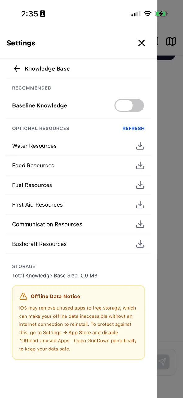
Each guide is researched from CDC, EPA, FEMA, USGS, and military field manuals, written for a stressed non-expert, and baked into the on-device AI. Browse them, or just ask.
How it works
iOS or Android. No account, no sign-in, no subscription servers between you and your data.
Pick your country and state maps, the overlays you want, and the model your phone can run. Do it once while you still have Wi-Fi.
Maps, routes, overlays, guides, and the assistant all run from the phone. Keep a power bank nearby and you're set for the long haul.
FAQ
Yes. Once your maps, databases, and AI model are downloaded, GridDown makes no network requests. The map tiles, the search index, the guides, and the language model all live on the phone. Every screenshot on this page was taken in airplane mode.
You get live Outdoor, Topo, and Streets base maps and online search on top of everything else. The moment the connection drops, the app falls back to its offline map and keeps going. Overlays, bookmarks, and routes behave identically either way.
A recent iPhone or Android phone. The on-device AI is the most demanding part, which is why there are four model sizes from 0.75 GB to about 4 GB. Older phones run the Standard model; newer ones can run Expert. Exact requirements will be published at launch.
You choose. A minimal setup (U.S. baseline map, one state, the Survival POI database, and the Standard model) is about 5 GB on top of the app. Everything, including every trail and infrastructure layer and the Expert model, is about 20 GB. Every download shows its size before it starts, and the app audits its own storage.
No. It's a knowledgeable reference that is available when nothing else is. It cites the guide it pulled from so you can read the full context, and it flags the situations where you need a professional or should not attempt something yourself.
The initial release covers the United States, with a world baseline map and state-level detail you download individually. The POI database is nationwide.
Pricing isn't final. Our goal is a one-time purchase with no subscription, because a subscription that needs a server defeats the point. Waitlist members hear first and get the launch price.

Join the waitlist and we'll email you once, when GridDown launches on iOS and Android. No newsletters, no drip campaigns.
By joining you agree to receive one launch email. Unsubscribe any time. See our privacy policy.